Saturday, July 22, 2006
Leita Thompson Memorial Park
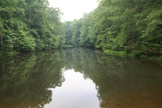
This nice little park is a hidden gem. It's right on Highway 92 sort of between Roswell and Woodstock. The park's pavillion is visible from the road, but the 2.5 miles of trails behind the pavillion are much less well-known. There are four "official" loop trails: red, blue, green and yellow. Red and Blue run concurrently throughout most of the park, with Red taking an extra .25 mile detour with the Yellow trail at one end. The Yellow loop runs for 1.12 miles along Blue and Red, and the short .25-mile Green loop circles the pond in the middle of the park. A couple of unmarked access trails are still visible, and a paved road runs through the park and provides access to a couple of buildings. The park land was once owned by Ms. Leita Thompson and some of the buildings are still used as private residences.
This is a great trail if you just need a little exercise or fresh air. It's almost entirely shaded, except for portions of the red/yellow trail that skirt the meadow behind the Arts Center. There are a lot of fallen trees throughout the park but the trail itself is well-maintained. There are enough hills and switchbacks to make it a decent workout. It's short enough to walk in an hour or so but interesting enought to spend more time if you want. There is a building near the pond that can be reserved for events, and a port-a-potty is there too. A drinking fountain is available at the parking area. Dogs are allowed on a leash and the city of Roswell kindly provides "poop bags" for you.
Sunday, July 09, 2006
Warwoman Dell
Warwoman Dell is a very pretty, secluded little recreation area near Clayton, GA. We visited on a Sunday morning and sadly did not have time to walk the entire (interpreted) trail, but I do hope we'll get to go back sooner rather than later. It's a sheltered, mossy glen for the most part, with some interesting ruins from an old CCC camp, and a railroad whose construction was never completed due to the interruption of the Civil War.
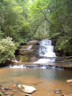
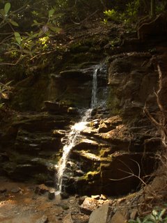
We did make it to the pretty little waterfall shown here. This is NOT Becky Branch Falls, however, which seems to be more popular and is nearby. We did not make it down to Becky Branch as we were short on time. The Bartram Trail also passes through or at least very near to this recreation area; again, we sadly did not have time to do much exploring on this trip.
There are a couple of picnic areas with grills and decent parking, but we were a bit nervous at first since we were towing the camper when we visited. We made it out safely, however!
Saturday, July 08, 2006
Stonewall Creek Falls
These pretty little falls were not really a hike, as we were able to drive right up to the primitive campsite that is at the base of the falls. There is a trail nearby however open to mountain bikers, and presumably to hikers also, and we did hike a little ways up it just to see what we could see.
The falls itself are small but pretty, but unfortunately the last group of campers to stay here apparently were either too drunk or too careless to pack out their garbage. Nevermind that they had to drive right past a dumpster on their way out. Anyway, we tried to ignore the trash and just enjoy the water, which of course the kids were busy throwing rocks into.
(Even though we were able to drive right up to the falls, not all cars would be able to. Without a high-clearance vehicle we would have had to stop at a parking area about a half-mile or so back down the mountain. Near the dumpster. But of course it made Martin's day to be able to drive someplace your average car couldn't.)
Angel and Panther Falls
This was our day's big adventure. We arrived at the Lake Rabun recreation area campground and parked near the Angel Falls trailhead. The smaller Panther Falls are, according to the sign at the trailhead, about a half-mile up the trail on the way to Angel Falls. According to the guide we used, it's more like two-thirds of a mile. At any rate, this was the easier portion of the climb, and really it wasn't bad at all. It would seem that whatever agency is in charge of this trail is planning to put some interpretive signage in, as we saw several blank signs/markers along the way. We also found a very cool stone bench on the side of the trail, but I could only wrangle one child into it as the others were far too busy being trail-blazers.
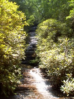
Panther Falls was a nice little stop and a pretty little fall. This is not an exceptional photo but it's what I have.
We enjoyed it for a bit then prepared for the last "600 yards" of very steep climb up to Angel Falls. It was very steep at first, even with a couple of switchbacks, and seemed much farther than 600 yards altogether. But climb we did, and climb and climb, and were eventually rewarded at the top with the much taller Angel Falls.
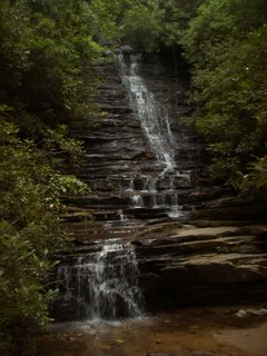
I have only the one photo of Angel Falls, for no sooner did I stop and begin to catch my breath on the observation deck, than the cry of "yellow jackets! Run!" caused a stir among ourselves. One of our travelling companions accidently stumbled into a yellow-jacket nest and an angry swarm took after him and the kids. When our youngest did not immediately return to the safety of the observation platform I began to worry, and went down after him. He came up the trail in tears and in pain, but proudly proclaiming that he did not get stung. Apparently in his rush to get away he tripped on a rock, and cut up and bruised his arm pretty good, but no stings.
It was a much less eventful and much more relaxing trip walking the mile back down to the picnic area for lunch afterward.
Minnehaha Falls
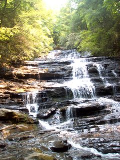
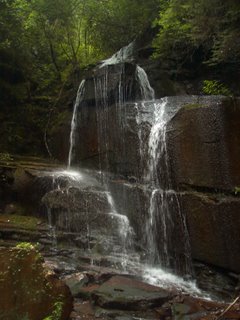
These beautiful falls reminded me of visiting Mingo Falls in Cherokee, NC. Fortunately, the climb to these falls was not nearly so difficult! The trail leading to the base of the falls is fairly short and not too difficult. The trail is marked and there is a sort of wide spot in the gravel road where you can park.
Our youngest was too beat from the adventure at Angel Falls to make this trip; he fell asleep in the back of the truck. But our eldest had a grand time here. We let her take off her shoes and splash around in the pool, looking for lizards and cool rocks and generally just enjoying the water.
There hasn't been much rain lately so I'm sure the falls were not as spectacular as they could be. But the low water made it possible for us to easily cross the creek and explore a little trail going down the other side. We found an old spring collection barrel under a rock overhang... it doesn't seem to be in use any more but the barrel still held water and a well-defined trail led down the slope away from it.
The rhododendrons were in bloom and we finally found someone who could tell us the difference between rhododendron and mountain laurel. (I knew what rhododendron was but there was some confusion over whether mountain laurel was the same thing, or something different, and what it looked like.) The woman we met there told us that mountain laurel is smaller with blossoms that look more like azaleas and bloom in late spring. I suspect that it is the orange-y blossoms I've always liked in late spring in the mountains.
Falls at Bad Branch
These pretty little falls were a little difficult to find. They are near Lake Seed but the trail that leads to them is not marked and though the guide book notes a pull-out for parking, we think that's a bit of a generous description. There is a camping/recreation area run by Georgia Power a bit further up the road. Directions to the falls are here.
It's a short hike up a gradual incline to the falls, not too steep but a little rocky. It looks like a few trees fell not too long ago right near the base of the falls, so it's a bit tricky to make your way around the area. You almost have to get right up to the water to get a clear view of the falls through the brush.
It was an uneventful hike for us and the kids had fun skipping rocks and splashing in the water once we got there. It was near the end of our day but the charm of walking around the little stream was not lost. We made them keep their shoes on this time though.
Subscribe to:
Posts (Atom)